MCP Agent Tools for Grasshopper Workflows
TYPE: Research
YEAR: 2025
Collaborators: Runjia Tian
YEAR: 2025
Collaborators: Runjia Tian
Parametric modeling has become central to contemporary architectural and landscape architectural
design, offering procedural control over complex geometries. Yet, interacting with these systems
typically requires specialized technical knowledge and manual manipulation of component networks, which can limit accessibility and slow down early-stage ideation. Our project introduces
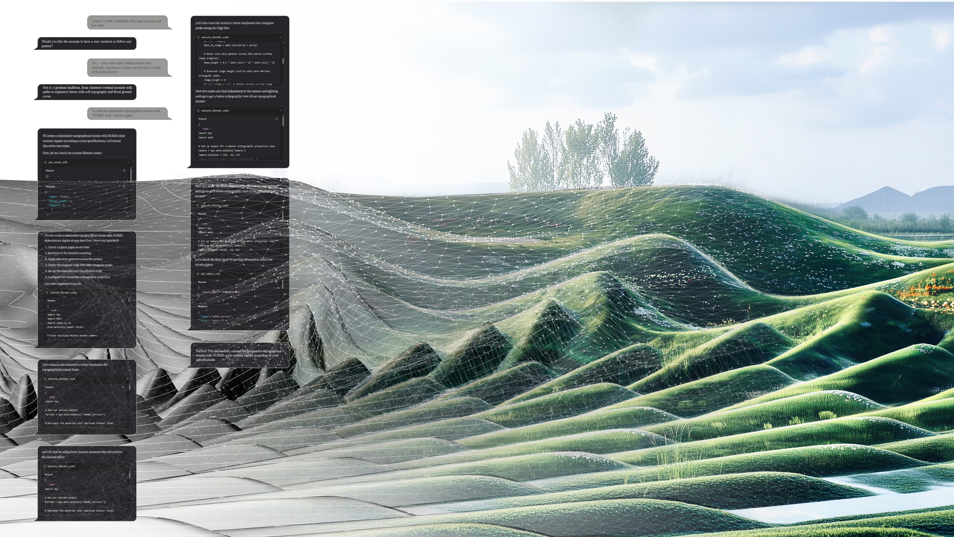
an MCP–Grasshopper integration that allows LLMs to act as intelligent design agents, transforming
natural language instructions into structured parametric modeling operations. Designers can articulate spatial and conceptual goals in conversational form, with the AI interpreting, constructing, and
modifying parametric definitions in real time.
Students worked on the prototyping phase in Digital FUTURES 2025 summer workshop:
http://digitalfutures.world/Data/List/ws2025
Students worked on the prototyping phase in Digital FUTURES 2025 summer workshop:
http://digitalfutures.world/Data/List/ws2025
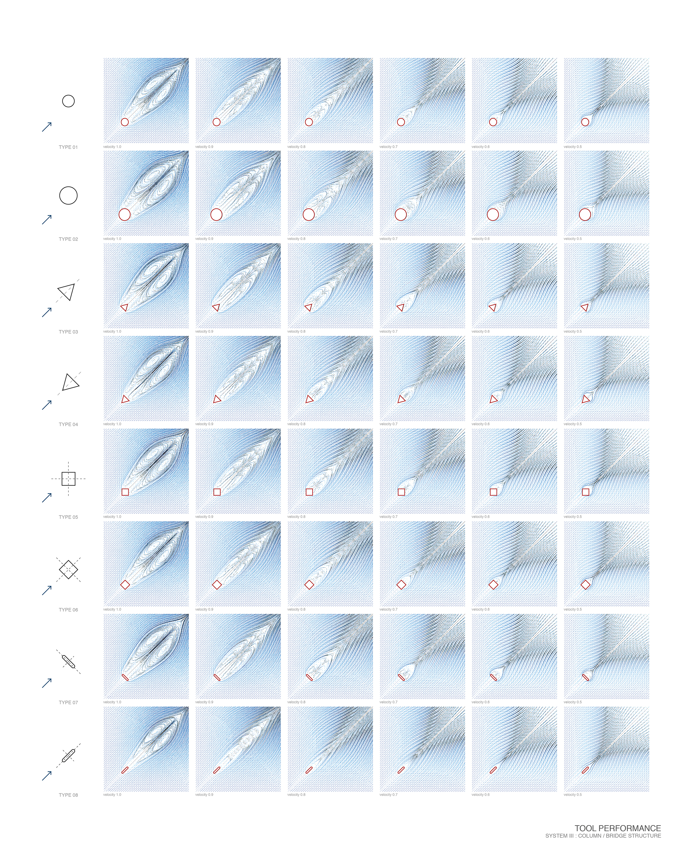
Scope
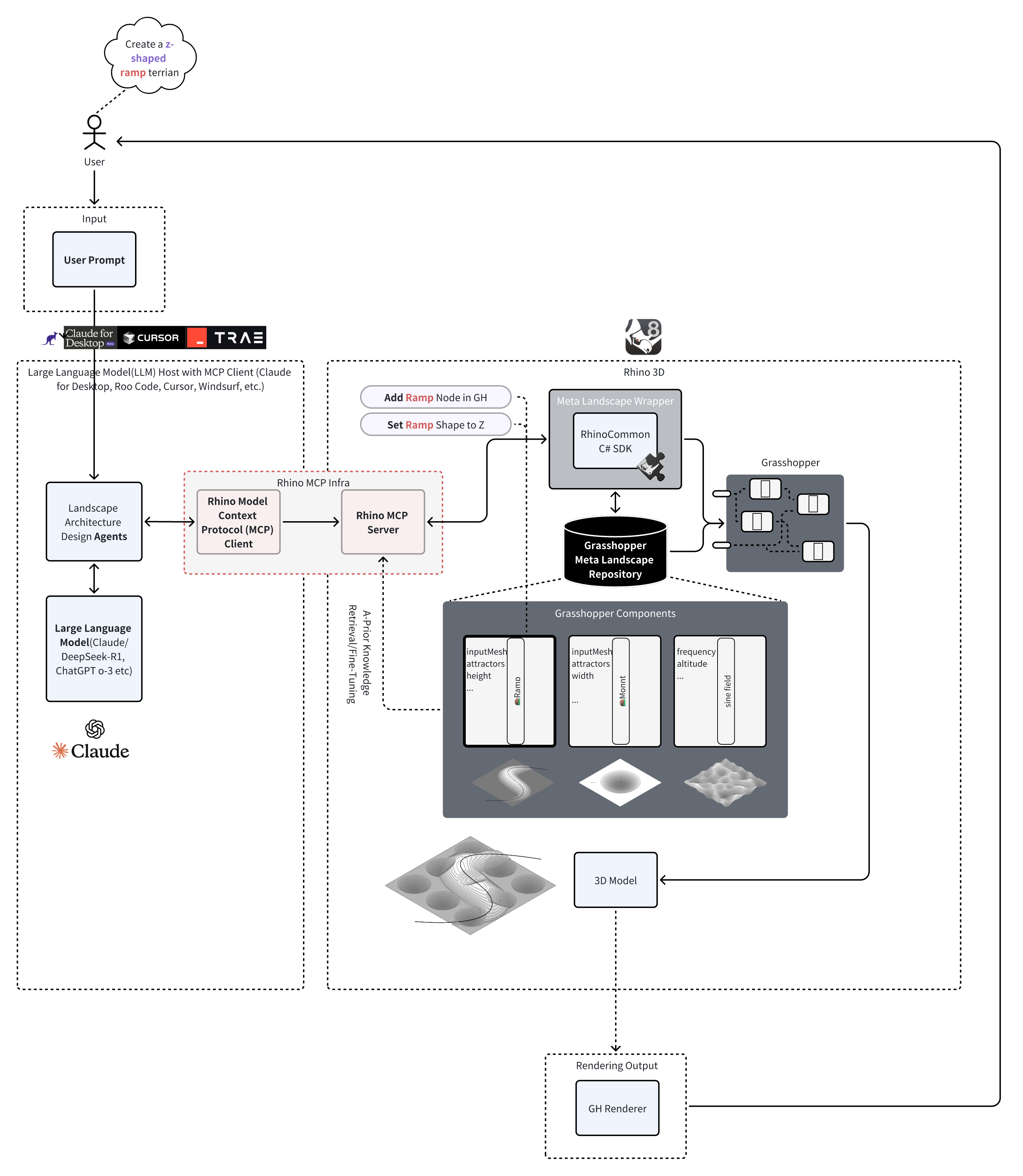
Methodology Framework
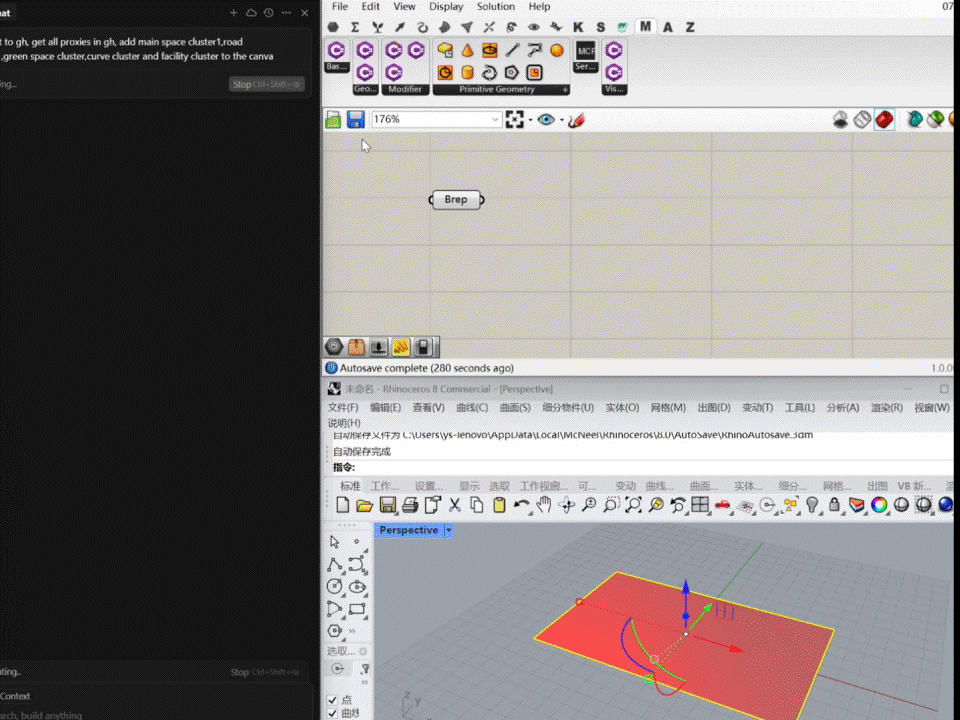 WIP Demo (more details comming soon)
A Generative AI Approach
TYPE: Research
YEAR: 2023
Collaborators: Nandi Yang (SWA)
Funding: Supported by Patrick T. Curran Fellowship
YEAR: 2023
Collaborators: Nandi Yang (SWA)
Funding: Supported by Patrick T. Curran Fellowship
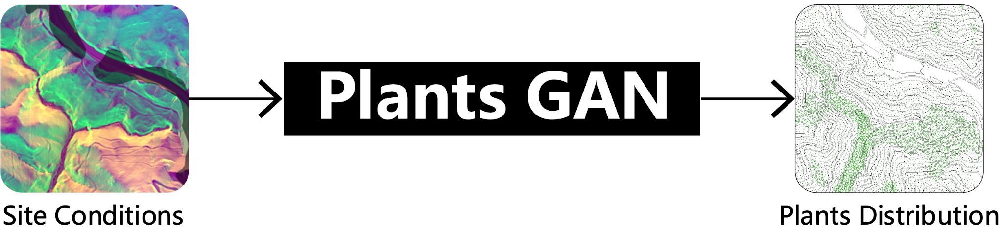
In the field of landscape
architecture, the integration of ecological principles with aesthetic design is
a critical yet complex task. This research introduces an innovative AI-driven
tool designed to revolutionize planting design by embedding ecological
intelligence into the design process. This paper presents the methodology,
including data synthesis, AI model training with generative adversarial
networks (GANs), and integration into a practical design interface. The model
is trained on multifaceted input data such as topography, soil, and climate
data. The results indicate the AI model's effectiveness in generating planting
layouts that balance ecological accuracy with aesthetic appeal. Significantly,
this research extends the professional practice of landscape architecture.
Full article can be found:
https://gispoint.de/fileadmin/user_upload/paper_gis_open/DLA_2024/537752020.pdf
Full article can be found:
https://gispoint.de/fileadmin/user_upload/paper_gis_open/DLA_2024/537752020.pdf

Methodology Framework

Rhino/Grasshopper Interface. We prototyped our Interface called ECO GEN using HumanUI in Grasshopper

Form finding, generative design integration
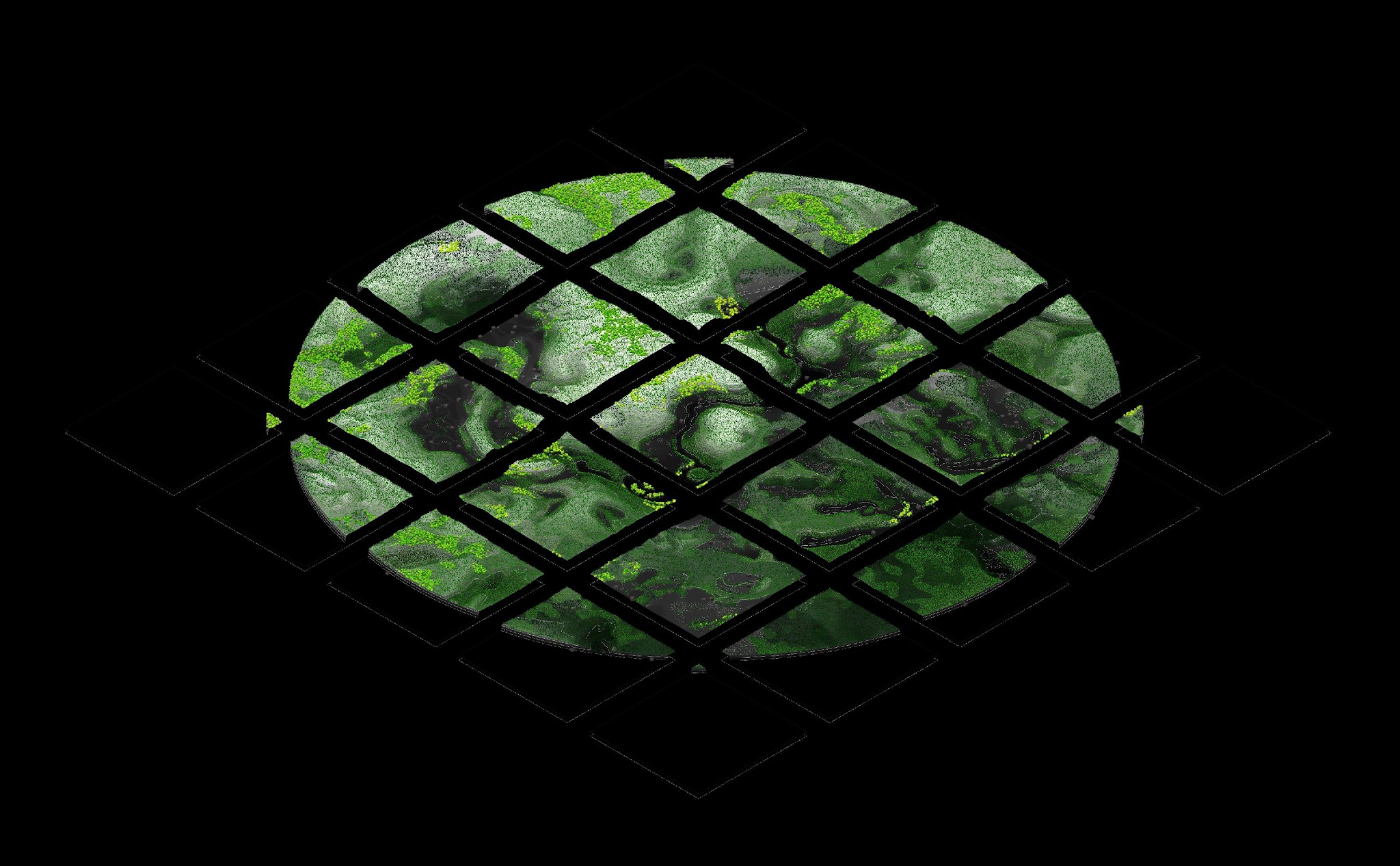
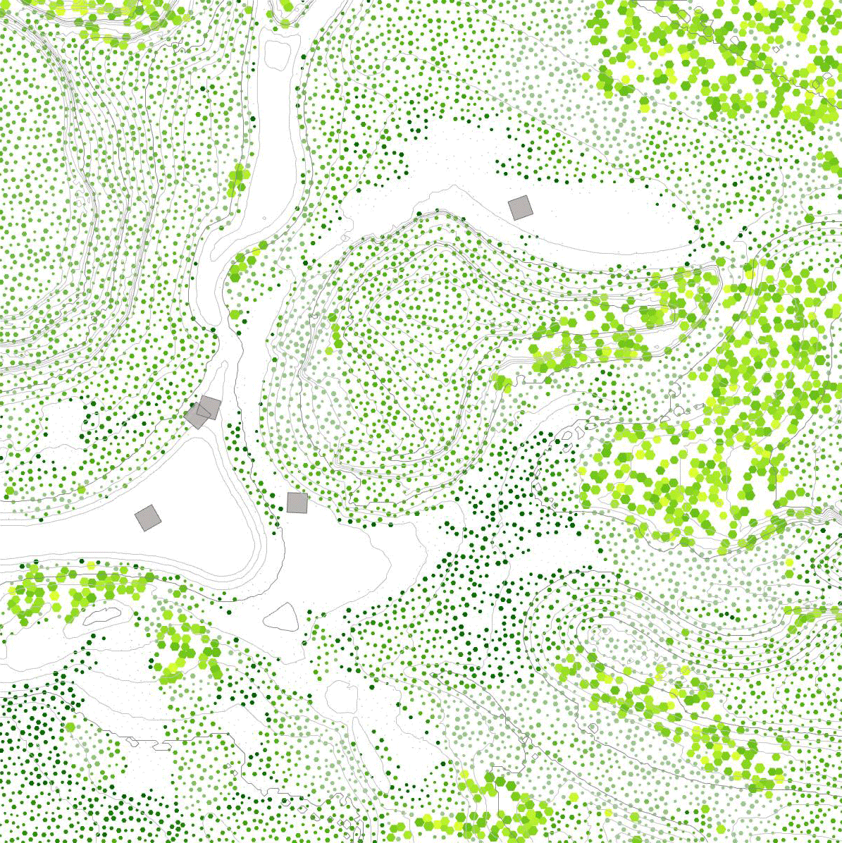

Iterative Design Process and Final Plating Layout Design Visualization

TYPE: Research
YEAR: 2024
YEAR: 2024
WIP tutorials can be found: landscapearchitecture.ai
Augmented Reality Fluvial Modeling Tool
TYPE: Research
YEAR: 2019
YEAR: 2019
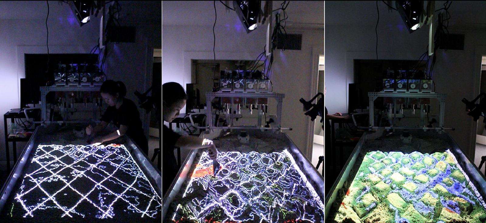
In recent design discourse in landscape architecture, ecological and
environmental concerns have stimulated a shift from rigid formal practice to
design of dynamic systems that are constantly in fluctuation. The digital
revolution has provided landscape architects intelligent tools to challenge the
determinacy of traditional static simulation and modeling method. However, it
has also distanced physical material exploration from the standard protocols of
the discipline. This research presents the use of small tangible hydromorphology
table as new workflows and methods of design for landscape architectural interventions
within hydrological systems. By integrating physical hydraulic simulation model
with real-time computational fluvial simulation through augmented reality
technologies, the new method enables landscape architects to design intuitively
with tangible material process, while being informed by computational
simulation results simultaneously.
A Hydrodynamics Visualization and Modeling Tool
TYPE: Research
YEAR: 2016
INFO: Developed in course GSD 6349 Mapping II : Geosimulation
INSTRUCTOR: Robert Gerard Pietrusko
PUBLICATION: Landscape Architecture Magazine
YEAR: 2016
INFO: Developed in course GSD 6349 Mapping II : Geosimulation
INSTRUCTOR: Robert Gerard Pietrusko
PUBLICATION: Landscape Architecture Magazine
Though
there are lots of off-the-shelf tools available for fluvial modeling, none of
the tools are developed specific for quick prototyping landforms. As for design
purpose, we prefer quick prototyping process and direct visualization to high precision
of every simulation numbers. Moreover, in order to fully integrate the numerical model into the
physical model, it is necessary to customize our own tool, to ensure real-time
feedback and adjustable parameters.
FluX is a computational tool designed for landscape designer to visualize the fluid dynamics and also interactively model the flow in an existing site or their designed landform. It’s an interactive prototyping tool, that designers can select their intervention types based on the hydrological performance and directly draw their interventions and get the real-time feedback. It’s a geo-based modeling tool, that landscape designers can get the real-world dataset from GIS and weather data from website and designed based on real world data. It’s also a hydrodynamics-based evaluation tool. Based on fluid simulation, other agents like sedimentation and vegetation properties can be evaluated.For example, landscape designers can use it to make planting decisions. They can develop planting strategies based on the flow, by selecting the plants species, properties, where to seed them and how many to put. The seed propagating path is based on flow and succession of different species is based on their own properties and competition with each other.
More information:
https://github.com/xunliuDesign/FluX
https://vimeo.com/212527838