A Hydrodynamics Visualization and Modeling Tool
TYPE: Research
YEAR: 2016
INFO: Developed in course GSD 6349 Mapping II : Geosimulation
INSTRUCTOR: Robert Gerard Pietrusko
PUBLICATION: Landscape Architecture Magazine
YEAR: 2016
INFO: Developed in course GSD 6349 Mapping II : Geosimulation
INSTRUCTOR: Robert Gerard Pietrusko
PUBLICATION: Landscape Architecture Magazine
Though
there are lots of off-the-shelf tools available for fluvial modeling, none of
the tools are developed specific for quick prototyping landforms. As for design
purpose, we prefer quick prototyping process and direct visualization to high precision
of every simulation numbers. Moreover, in order to fully integrate the numerical model into the
physical model, it is necessary to customize our own tool, to ensure real-time
feedback and adjustable parameters.
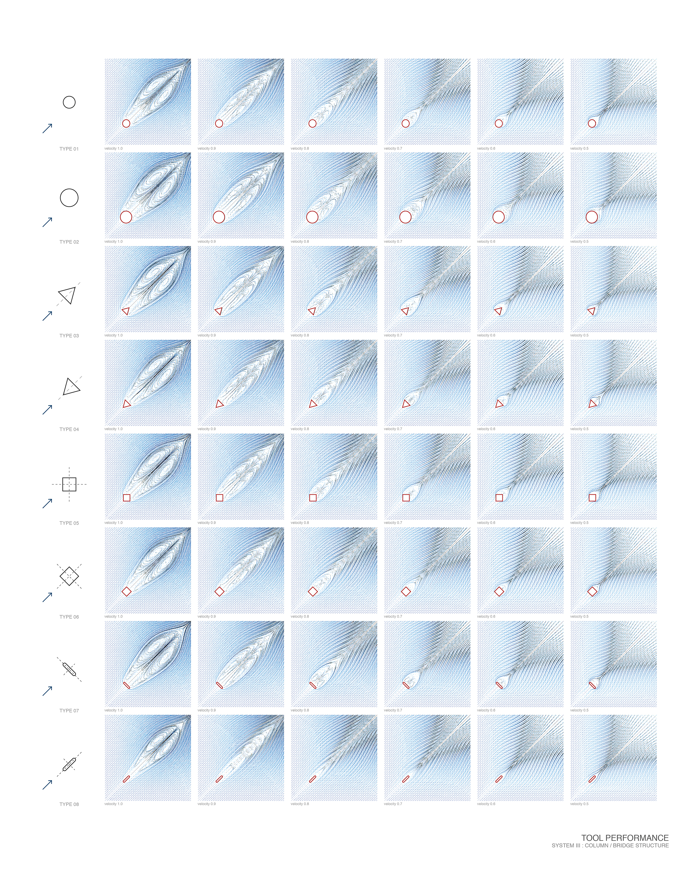
FluX is a computational tool designed for landscape designer to visualize the fluid dynamics and also interactively model the flow in an existing site or their designed landform. It’s an interactive prototyping tool, that designers can select their intervention types based on the hydrological performance and directly draw their interventions and get the real-time feedback. It’s a geo-based modeling tool, that landscape designers can get the real-world dataset from GIS and weather data from website and designed based on real world data. It’s also a hydrodynamics-based evaluation tool. Based on fluid simulation, other agents like sedimentation and vegetation properties can be evaluated.For example, landscape designers can use it to make planting decisions. They can develop planting strategies based on the flow, by selecting the plants species, properties, where to seed them and how many to put. The seed propagating path is based on flow and succession of different species is based on their own properties and competition with each other.
More information:
https://github.com/xunliuDesign/FluX
https://vimeo.com/212527838