NYC Digital Zoning Automation and Analysis
TYPE: Professional
YEAR: 2018-2019
YEAR: 2018-2019
The practice of city-wide zoning defines potentials of both building forms and public space, through a set
of static prototypes (ie. zoning districts, lot types) and rules (ie, setbacks, incentives). “Code2Code” is a digital toolkit under development for New York City Department of City Planning, including automating
3D scenario of existing/proposed zoning code, enhancing the workflow of rezoning studies, and performancebased
planning research.
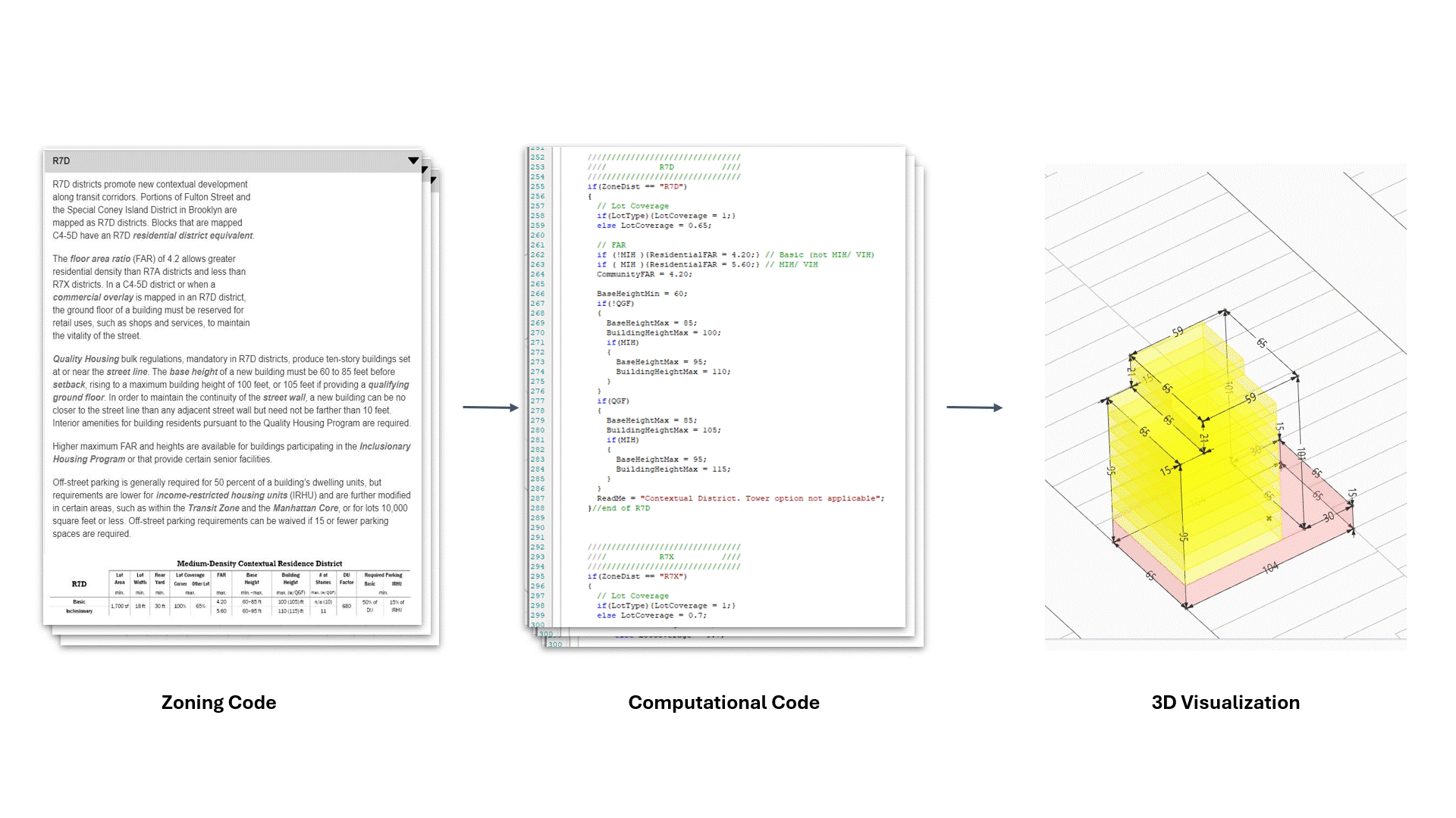
It translates zoning regulations into computational languages and automatically generates building massing based on GIS data. The tool has saved 90% time and cost per zoning study, resulting in cost savings in the hundreds of thousands of dollars in the agency. The new tools has significantly speed-up the traditional GIS-Modeling-Calculating- Remodeling process, thus the leap from quantitative to qualitative change enable more relational and integrated studies of the city.
It translates zoning regulations into computational languages and automatically generates building massing based on GIS data. The tool has saved 90% time and cost per zoning study, resulting in cost savings in the hundreds of thousands of dollars in the agency. The new tools has significantly speed-up the traditional GIS-Modeling-Calculating- Remodeling process, thus the leap from quantitative to qualitative change enable more relational and integrated studies of the city.
Concept of “Code2Code”
Iterative Zoning-GIS-Modeling-Calcuating-Remodeling Process
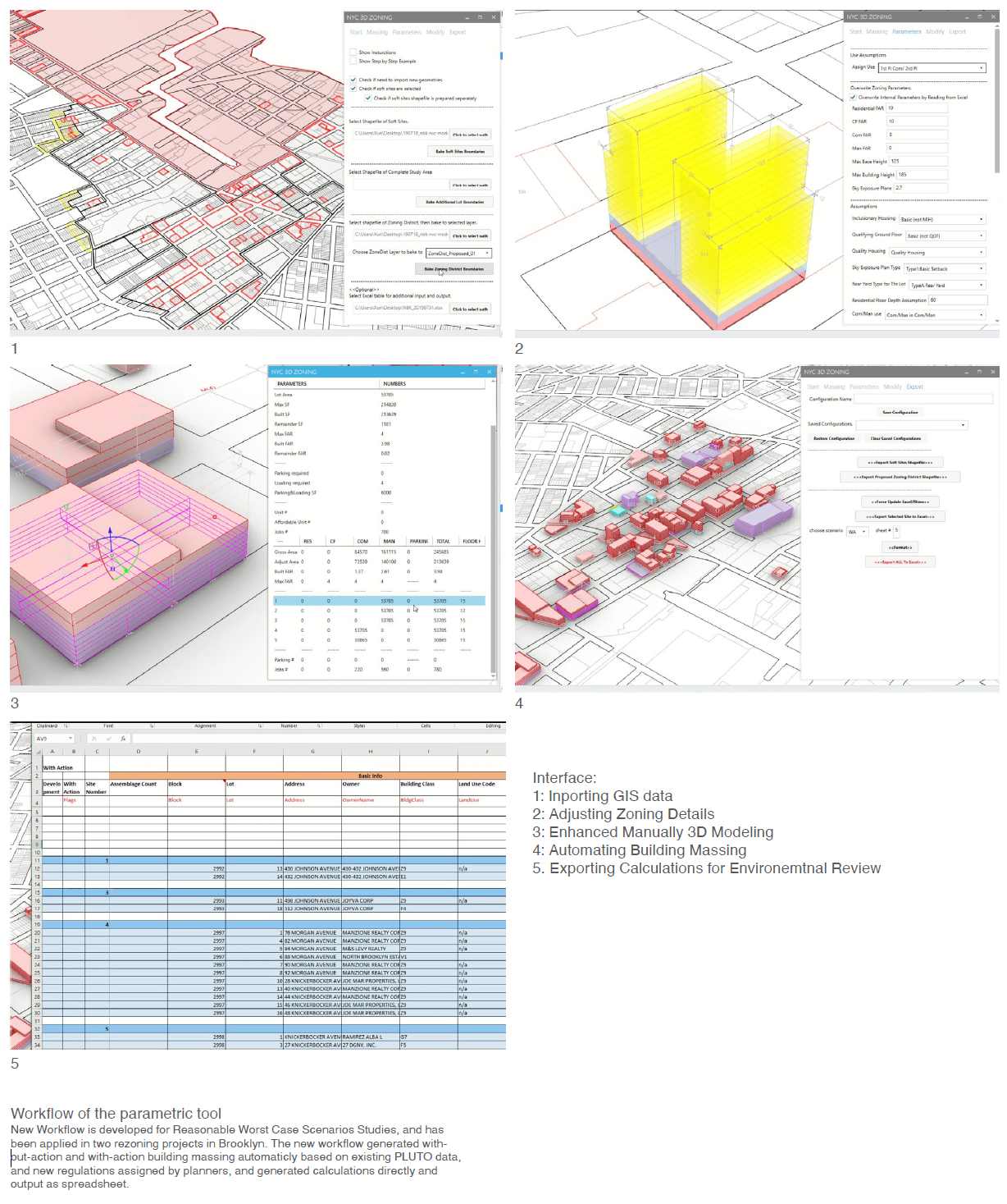
Interface of the Tool

User Interface

Behind the scene
Planners are
able to connect the model to multiple GIS
data source, this linkage allows the agency to “read” underlying GIS data
through a 3D-model and to use that data to produce new models.
Any modification can also be exported out
to GIS.
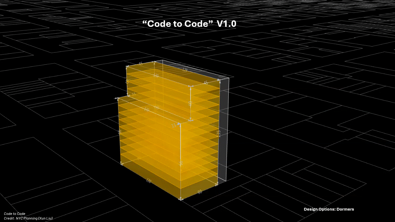
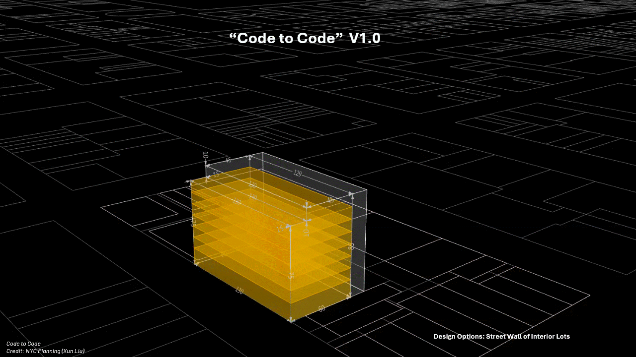
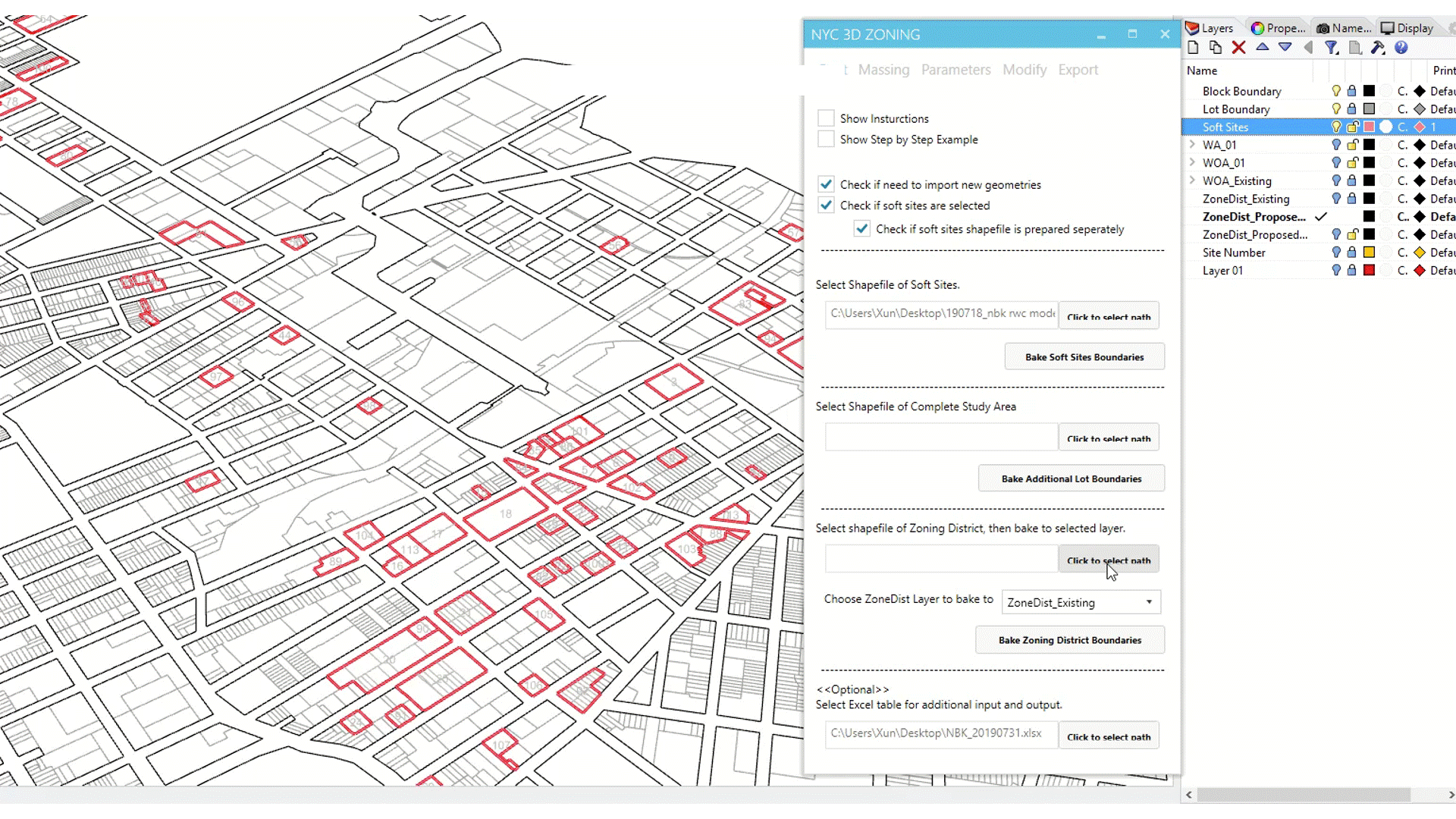
Instead of manually adjust all imbedded
parameters, the planners can directly type in any proposed zoning district, to
visualize different scenarios. A typical use is to visualize the increasement
of massing when a district is upzoninged from a lower density district to a
higher density zoning district.
If the regulations for certain zoning
district need to be adjusted, the tool also allows more subtle modifications of
most of the detailed parameters, such as different FARmaximum
building height limit, the slope of sky exposure plan, the combination of
different use, etc.![]()
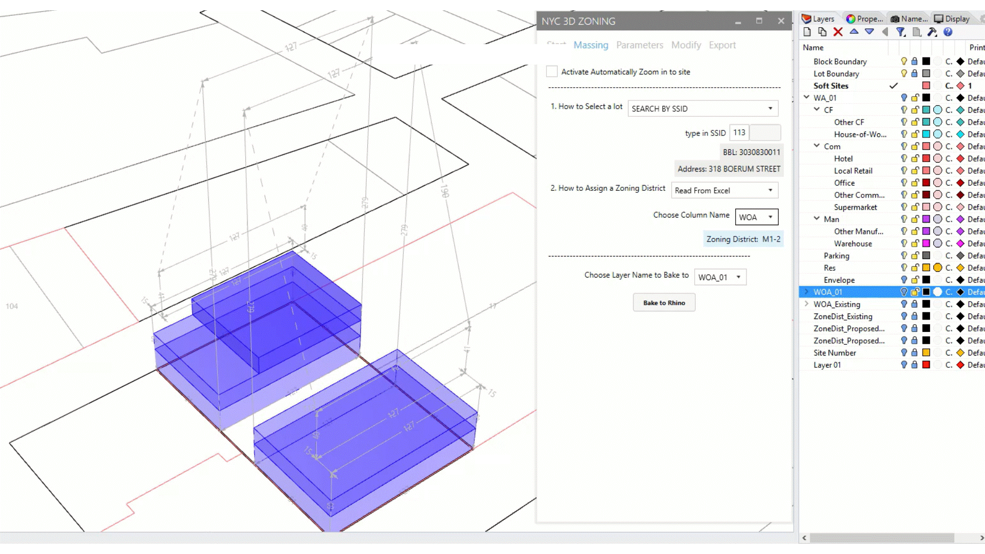
This
tool still allows designers to adjust massings manually, based on specific
conditions and parameters that may be site specific or cannot be generated
automatically. The
designers can detect changes in the calculations simultaneously, so the
manually modeling process is also more accurate and faster.
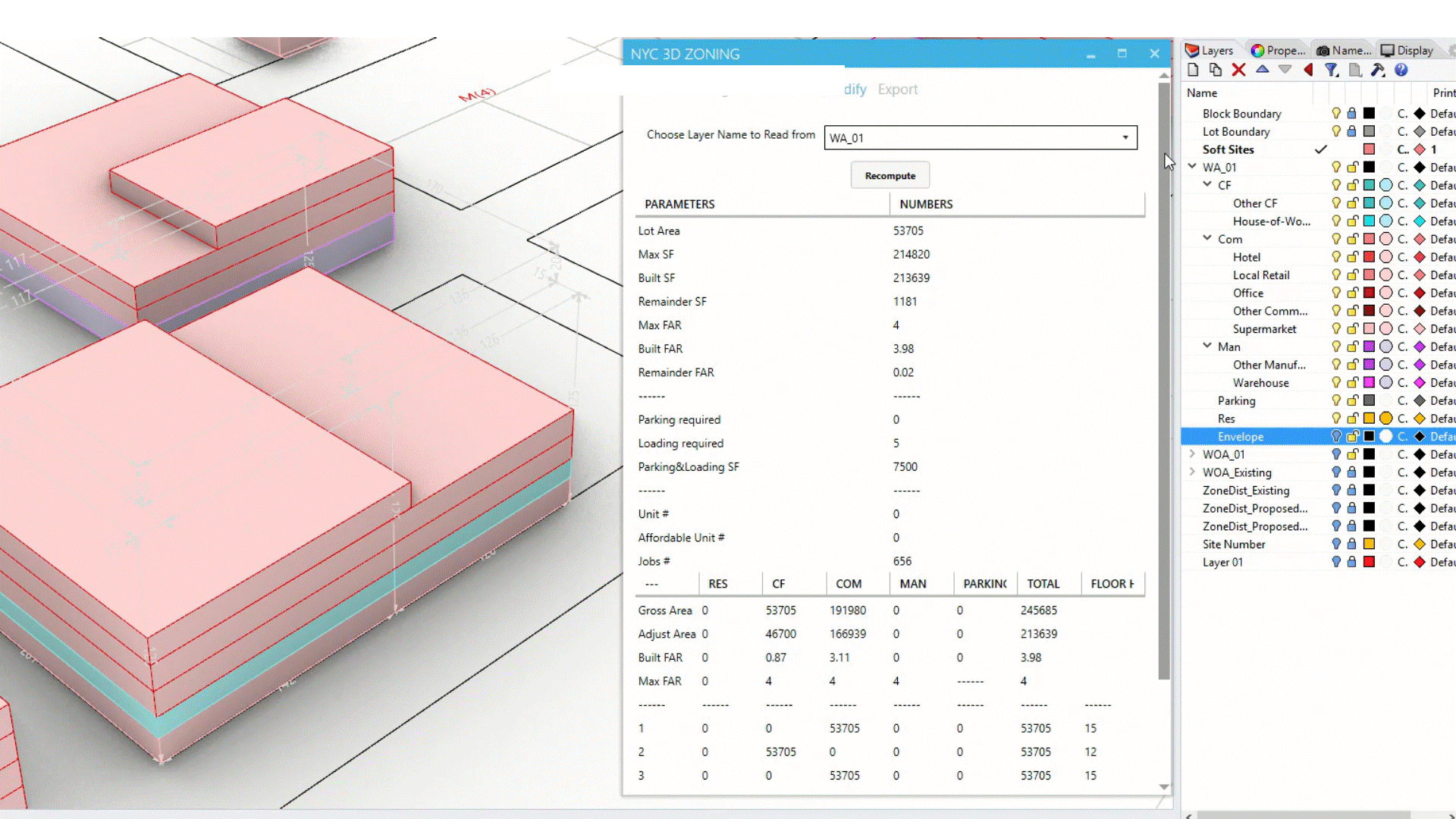
![]() It allows automation of generating
buildings on multiple sites, which will significantly increase the efficiency,
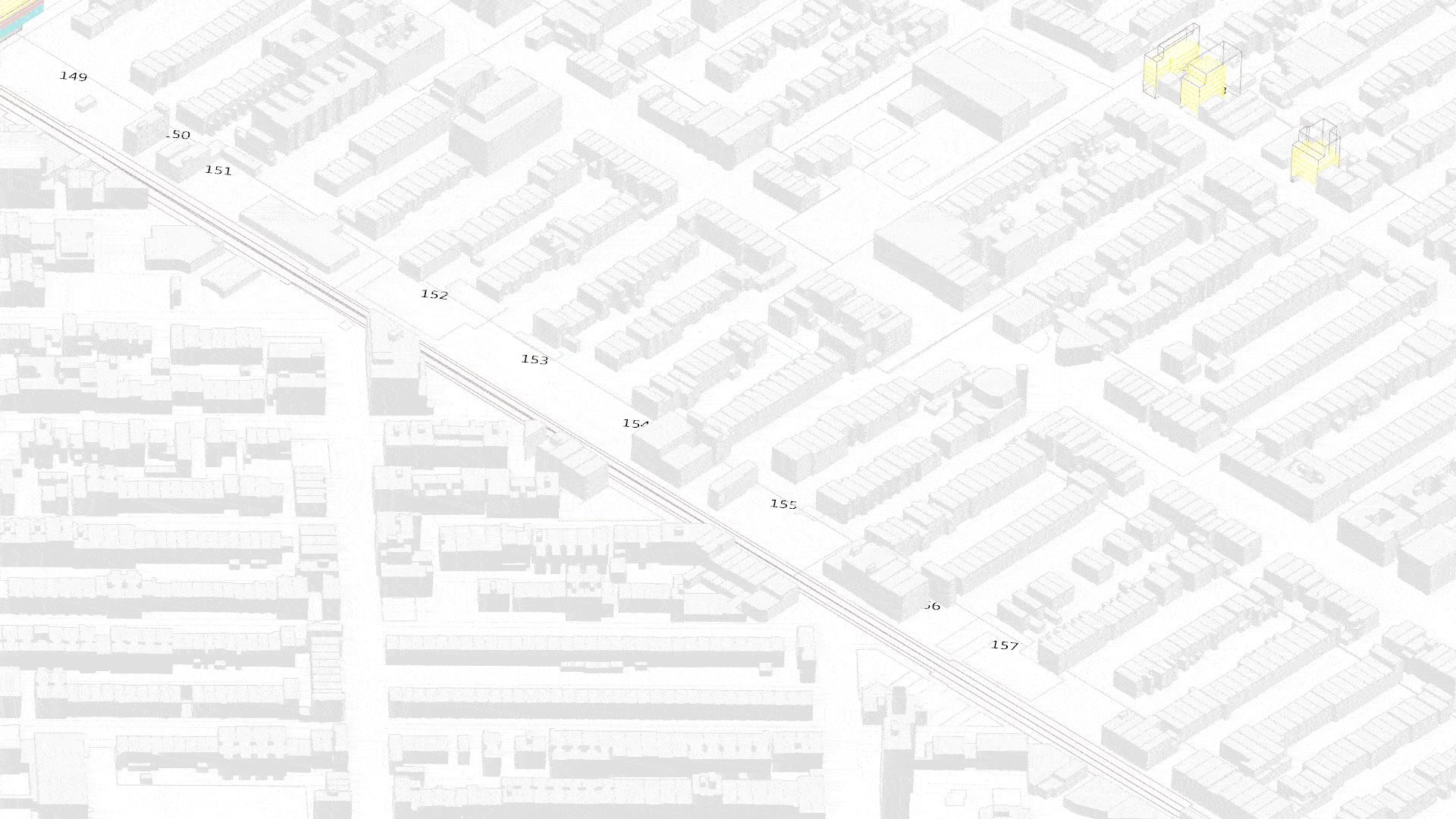
and allows city-wide analysis. In this project, for example, including manually
adjusting, more than 200 sites are studied by 3 designers within two days,
which would usually take more than one month for a team to do the modeling and
analysis.
It allows automation of generating
buildings on multiple sites, which will significantly increase the efficiency,
and allows city-wide analysis. In this project, for example, including manually
adjusting, more than 200 sites are studied by 3 designers within two days,
which would usually take more than one month for a team to do the modeling and
analysis.
 It allows automation of generating
buildings on multiple sites, which will significantly increase the efficiency,
and allows city-wide analysis. In this project, for example, including manually
adjusting, more than 200 sites are studied by 3 designers within two days,
which would usually take more than one month for a team to do the modeling and
analysis.
It allows automation of generating
buildings on multiple sites, which will significantly increase the efficiency,
and allows city-wide analysis. In this project, for example, including manually
adjusting, more than 200 sites are studied by 3 designers within two days,
which would usually take more than one month for a team to do the modeling and
analysis.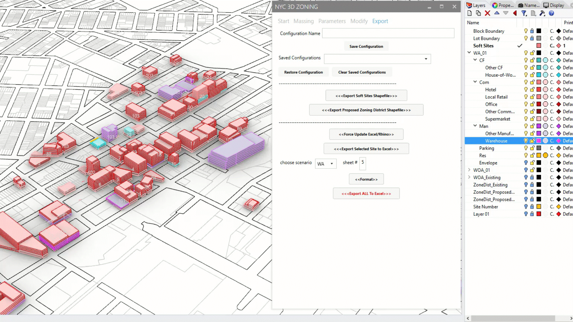
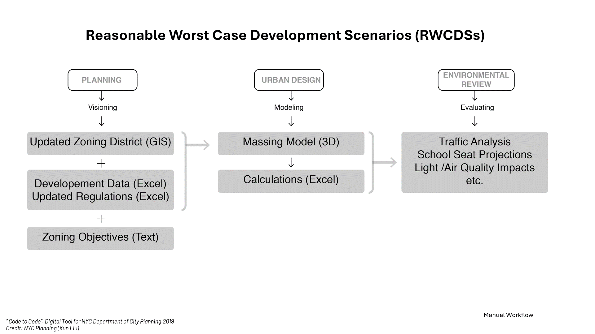
Lastly, once a site is massed, The
parametric tools automate the extraction of data from a model into an excel
table and allow for designers to track the data of an individual massing in
real time. This not only reduces time, but also effectively eliminates error in
the data extraction process, since all
of the data can be exported
automatically rather than input by hand incrementally.
Some demos of earlier versions:
![]()
![]()
![]()
![]()
![]()
![]()
Some demos of earlier versions: